Whom amongst us has not rehashed a long-running dispute mere days after committing to de-escalating tensions?
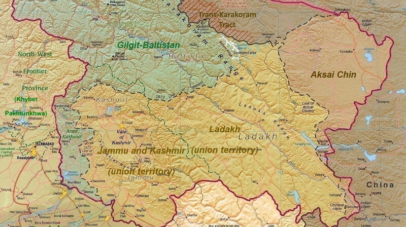
What happened: Per the BBC, India is taking issue with a newly released Chinese map that lays claim to what India considers its territory. The map in dispute shows the northeastern state of Arunachal Pradesh, and the disputed Aksai Chin plateau, as belonging to China.
- The 3,440 km border, known as the ‘Line of Actual Control,’ covers rivers, lakes, and snowcaps, meaning that the line can shift in places and is difficult to nail down.
Catch-up: Ambiguity about India’s frontier with China dates back to the colonial era, though both countries have never agreed on where the line lies. Over recent decades, attempts by China and India to build infrastructure along the disputed border have led to deadly clashes.
- Beyond ruining a few photo ops at next week’s G20 leader talks in India—President Xi Jinping will reportedly sit out—the new map could further complicate the issue.
Why it matters: China and India are kind of supposed to be getting along right now, as both work towards expanding the membership of BRICS, an economic partnership between (soon-to-be) eleven developing countries that aims to strengthen their position in the world.
Bottom line: Both sides can’t afford to let the issue drag on as they try (despite their differences and complicated history) and present a united front to the rest of the world.—SB